
Germany, Sep 7, 2026
In the first part of our series on drone technology, digital infrastructure and new use cases, we showed why a drone can be much more than a flying camera system. The technology itself is only one part of the equation. What matters is how different components work together to create practical solutions for real-world applications.
The next step is capturing relevant data directly in the field.
Before data can be turned into digital models, analyses or intelligent applications, the relevant information first needs to be captured reliably. This is where Field Data Capture comes in – and it is also where our approach at Logicalis begins: rather than looking at technologies in isolation, we combine them into solutions tailored to specific use cases.
Capturing the environment with precision
Whether expanding power grids, deploying fiber-optic networks or working in rail infrastructure, having an accurate understanding of the existing environment is an important foundation for planning, documentation and subsequent maintenance.
Traditional photographic documentation alone is often not enough. What is needed is accurate, structured and as-complete-as-possible data that can subsequently be processed and used digitally.
Field Data Capture therefore combines different data acquisition methods. Depending on the use case, these can include:
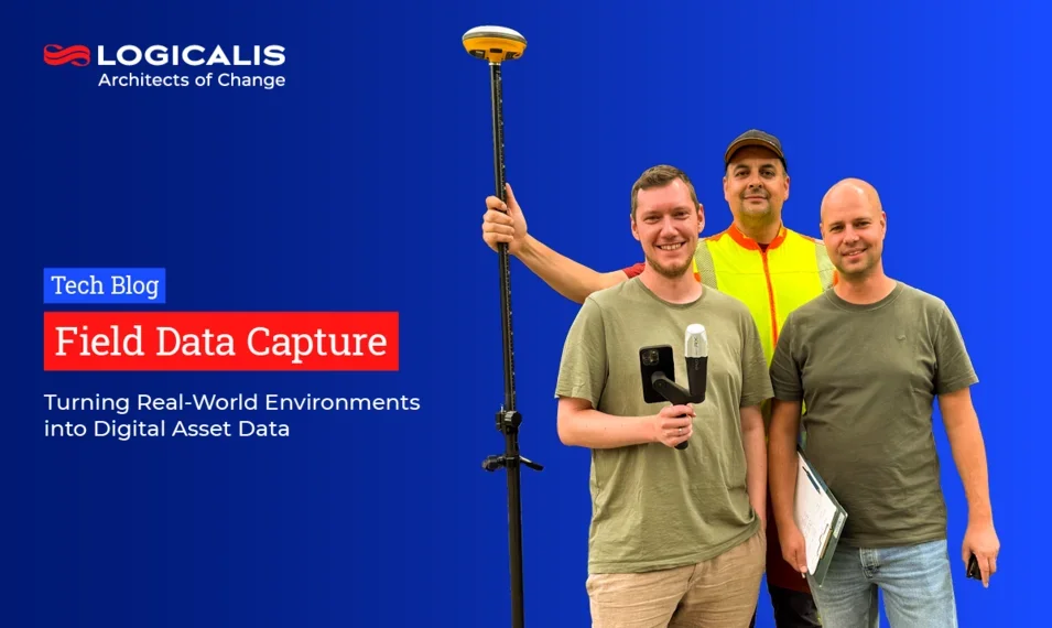
- drones equipped with cameras and LiDAR sensors,
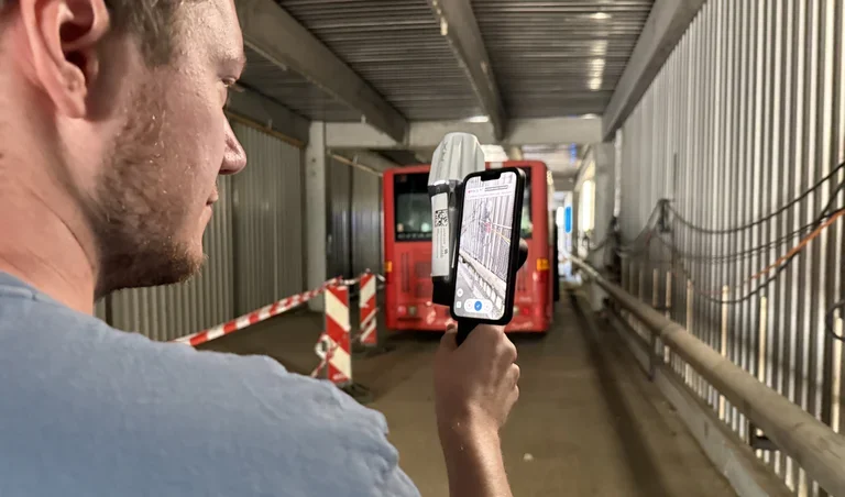
- mobile handheld systems with LiDAR and GNSS,
- conventional GNSS-based surveying systems.
These technologies can be combined to create a highly detailed digital representation of the captured environment – from individual objects to larger areas and facilities.
Drone or Handheld? It depends on the Use Case
One of the key strengths of Field Data Capture lies precisely in combining different technologies.
Drones enable large areas to be captured quickly from the air and can also document areas that are difficult or costly to access. With the right sensors, they can capture not only imagery but also precise spatial data.
Handheld systems complement this perspective from the ground. They are particularly well suited to detailed surveys of buildings, facilities or trenches in civil engineering projects, where capturing data at ground level is more practical.
The different datasets can then be used to generate 3D point clouds. These digitally represent the spatial environment and provide a basis for further processing – for example, as part of Scan-to-BIM workflows.
The result is therefore more than a collection of individual images: it is a digital representation of the real-world environment.
Documenting existing infrastructure where it matters
The relevance of this approach becomes particularly clear in infrastructure projects.
When expanding fiber-optic or power networks, existing conditions need to be captured and documented. In rail infrastructure, for example, platforms, track systems and adjacent areas can be digitally surveyed.
These types of use cases were also at the heart of a multi-day field test at the Rescue Campus of FBI GmbH in Amstetten. Under real-world conditions, different data acquisition methods and systems were tested and compared for creating georeferenced 3D point clouds.
Among other scenarios, a platform inspection was simulated to demonstrate how such an approach could be used for infrastructure asset documentation. Different areas of the campus were captured using various systems, allowing the capabilities of the individual technologies to be assessed and compared.
For us at Logicalis, one thing is particularly important: there is no single technology that is the right fit for every scenario. Together with our partners, we therefore look at the specific use case and assess which combination of drone technology, sensors and surveying technologies best meets the requirements.
Above all, the field test demonstrated one key point: the right data acquisition technology always depends on the specific use case.
From individual sensors to an end-to-end process
Field Data Capture therefore does not begin when a drone takes off. Reliable asset documentation requires an end-to-end process – from selecting the right sensors and capturing the data to processing the information collected.
This involves questions such as:
What needs to be captured?
Which objects, areas or infrastructure assets need to be documented?
Which technology is best suited to the task?
Is a camera-based survey sufficient, or are additional LiDAR and GNSS data required?
How can different data sources be combined?
Drones, handheld systems and surveying equipment each provide different perspectives and types of information.
How will the results be used?
A point cloud is initially just a dataset. Its real value emerges when it can be integrated into downstream processes and applications.
It is precisely this connection between data capture, processing and use that turns individual measurements into a reliable digital asset documentation process.
Technology for critical infrastructure
For critical infrastructure in particular, data quality is only part of the equation. The technology itself must also meet the requirements of the environment in which it is deployed.
As part of our joint project with FBI GmbH and Emqopter, we are therefore using, among other technologies, a drone platform developed and manufactured in Germany. Emqopter’s modular approach allows the drone to be adapted to different requirements and use cases.
This opens up opportunities for applications where robust and flexible systems are required – for example, for infrastructure documentation and inspection.
From technology components to solutions
This is where the value of our approach at Logicalis becomes clear: we do not view Field Data Capture as an isolated drone application, but as part of a broader solution process.
From selecting the right sensors and capturing and processing the data to integrating the results into existing IT and infrastructure environments, we consider the individual components as part of a connected solution.
The field test at the Rescue Campus demonstrated just how much requirements can vary depending on the deployment environment. For us, this kind of practical testing is essential for turning individual technologies into solutions that can be applied to real customer requirements.
But the process doesn’t stop there
Creating a 3D point cloud is not the end of the process. On the contrary, it provides the starting point for the next steps.
How can captured data be stored and further processed to make it usable for AI applications? How can it be transformed into digital models and new applications? And what value can the information provide for planning, analysis and other processes?
At the same time, it becomes clear that a solution like this involves more than data capture and processing. Reliable connectivity and the long-term operation of the systems involved also play a critical role.
This highlights an important point: Field Data Capture is about much more than simply collecting data. It is an important building block for creating a digital representation of real-world environments – and, in doing so, laying the foundation for the next steps.
Das könnte Sie auch interessieren
Germany , Sep 4, 2026
Field Data Capture: Wie aus realen Umgebungen digitale Bestandsdaten werden
Bevor aus Daten digitale Modelle, Analysen oder intelligente Anwendungen entstehen können, müssen die relevanten Informationen zunächst zuverlässig aufgenommen werden. Genau hier setzt Field Data Capture an.
Germany , Aug 11, 2026
Penetrationstests sind nicht das Endziel. Das Ziel ist die proaktive Reduzierung von Sicherheitsrisiken.
Für die meisten CISOs stellt sich die Frage nach Penetrationstests nicht mehr, ob sie durchgeführt werden sollen. Regulatorische Erwartungen, Anforderungen von Cyberversicherungen und die Kontrolle durch den Vorstand haben solche Tests unvermeidlich gemacht.
Germany , Aug 11, 2026
Penetrationstests im Jahr 2026: 10 Veränderungen, die Sicherheitsverantwortliche kennen müssen
Warum jährliche Penetrationstests nicht mehr ausreichen und wie ein plattformbasierter Ansatz für das Schwachstellenmanagement, der rund um die Uhr verfügbar ist, der Schlüssel zur Verringerung von Cybersicherheitsrisiken sein könnte.
Germany , Aug 10, 2026
Der Angriff vor dem Angriff: Warum Unternehmen frühzeitig Einblick in Cyberrisiken benötigen
Die meisten Cyberangriffe beginnen nicht mit einem Alarm im Security Operations Center. Sie beginnen schon früher – mit einem durchgesickerten Passwort, einer gefälschten Domain, einem kompromittierten Lieferantenkonto oder der Erkundung ungeschützter Systeme.
Germany , Aug 6, 2026
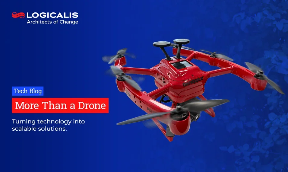
More Than a Drone: How Logicalis Develops Scalable Solutions Together with Customers and Partners
Innovation rarely comes from a single technology alone. The real value is created when different areas of expertise, systems, and data sources are brought together. This is exactly where Logicalis comes in. We bring together technology partners, customer requirements, and digital infrastructures to create solutions that deliver real value in practice.
Germany , Aug 5, 2026
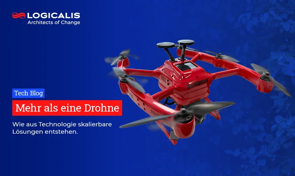
Mehr als eine Drohne: Wie Logicalis aus Technologie mit Kunden und Partnern gemeinsam skalierbare Lösungen entwickelt
Innovationen entstehen selten durch eine einzelne Technologie. Der wirkliche Mehrwert entsteht dort, wo unterschiedliche Kompetenzen, Systeme und Datenquellen zusammengeführt werden. Genau hier setzt Logicalis an: Wir verbinden Technologiepartner, Kundenanforderungen und digitale Infrastrukturen zu Lösungen, die in der Praxis funktionieren.
Germany , Jul 9, 2026
Logicalis startet mit Microsoft Frontier Partner-Status und Copilot-Spezialisierung in die nächste Phase der Enterprise-KI
Logicalis gibt den Microsoft Frontier Partner-Status sowie zwölf Microsoft Advanced Specialisations bekannt – darunter Spezialisierungen für das gesamte Security-Portfolio, Azure Expert MSP und Modern Work mit Microsoft 365 Copilot.
Germany , Jul 7, 2026
Die Einführung von KI beschleunigen: Logicalis erhält Status als „Microsoft Frontier Partner“
Der neue Status als „Microsoft Frontier Partner“ und die ebenfalls erreichte Copilot-Spezialisierung stärken die Fähigkeit von Logicalis, Unternehmen auf dem Weg von ersten KI-Projekten hin zu einer sicheren und geregelten Einführung zu unterstützen.
Germany , Jun 23, 2026
Skalierung von KI: Warum die Ambitionen die Bereitschaft überholen
Bislang ist die Unternehmenslandschaft im Jahr 2026 geprägt vom Streben nach KI und deren Integration. Das Interesse der Unternehmen hat einen Höhepunkt erreicht, und laut einer aktuellen weltweiten Studie des „Logicalis Global CIO Report“ geben 94 % der IT-Führungskräfte an, dass der Wunsch nach dem Einsatz von KI im Vergleich zu vor nur 12 Monaten gestiegen ist.
Daten in Bewegung, Sicherheit durch Design: Architektur für das Zeitalter der KI
Das Zeitalter der künstlichen Intelligenz erfordert mehr als nur vereinzelte Technologieentscheidungen. Erfahren Sie, wie Logicalis und Cisco Unternehmen dabei unterstützen, das richtige Ökosystem aufzubauen, um KI sicher zu skalieren und komplexe Infrastrukturen in eine Plattform für Wachstum zu verwandeln.
Germany , Apr 30, 2026
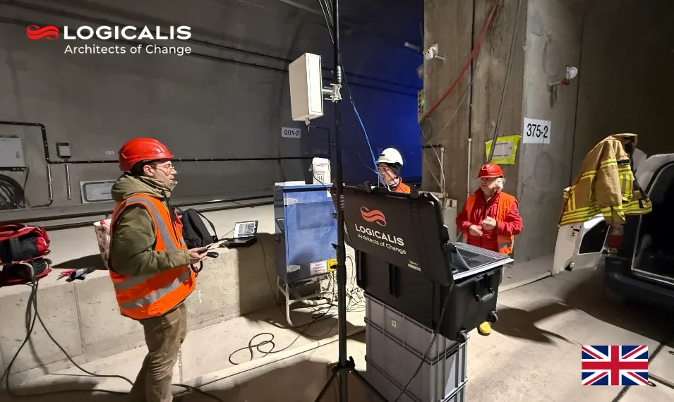
5G Geopositioning in Real-World Testing – New Insights from a Tunnel Environment
Last year, together with our partners, we demonstrated in an early field test how 5G geopositioning performs outside the laboratory under real-world conditions.With the current test, we have consistently continued this approach and taken a closer look.
Germany , Apr 30, 2026
5G-Geopositionierung im Praxistest – neue Erkenntnisse aus dem Tunnelumfeld
Im vergangenen Jahr haben wir gemeinsam mit unseren Partnern im Rahmen des Early Field Tests gezeigt, wie sich 5G-Geopositionierung außerhalb des Labors unter realen Bedingungen bewährt.Mit dem aktuellen Test haben wir diesen Ansatz konsequent weitergeführt und einen Schritt tiefer geschaut.

Germany , Apr 13, 2026
Logicalis CIO-Report 2026 (Teil 2): KI rückt als Cyberrisiko in den Fokus
Der jährliche CIO-Report von Logicalis, internationalem Anbieter von IT-Lösungen und Managed Services, zeigt, dass die Sicherheit im Umgang mit Künstlicher Intelligenz (KI) für CIOs zu einer obersten Priorität geworden ist; mehr als ein Viertel der Befragten gibt an, dass KI eine erhebliche Risikoquelle darstellt.
Germany , Mar 25, 2026
Logicalis Deutschland akquiriert NetworkedAssets und baut Präsenz in Polen auf
Logicalis Deutschland, internationaler Anbieter von IT-Lösungen und Managed Services, akquiriert das Unternehmen NetworkedAssets, spezialisiert auf Softwareentwicklung, Netzwerkautomatisierung und -diagnostik. Die Akquisition umfasst sowohl den deutschen Standort des Unternehmens in Berlin als auch den polnischen in Breslau, an dem ein Großteil der Mitarbeiter tätig ist.
Germany , Mar 5, 2026
Logicalis Deutschland besetzt CTO- und COO-Positionen neu
Das Führungsteam von Logicalis, internationaler Anbieter von IT-Lösungen und Managed Services, ist neu aufgestellt. Markus Hahn, bislang Chief Technology Officer (CTO) bei Logicalis Deutschland, übernimmt die Rolle des Chief Operating Officer (COO). Seine bisherige Position als CTO geht an Rony Mikhael, zuvor Director Networking, Collaboration & Security.
Germany , Mar 3, 2026
Logicalis CIO-Report 2026: CIOs navigieren durch steigende KI-Investitionen – inmitten wachsender Governance-Bedenken
Logicalis, internationaler Anbieter von IT-Lösungen und Managed Services, stellt in seinem aktuellen CIO-Report fest: Unternehmen investieren schneller in KI, als sie diese wirksam steuern können.

Germany , Nov 17, 2025
Von Netzwerk-Regelchaos zur Application Ownership
Mit DORA – dem Digital Operational Resilience Act der EU – ist für Finanzinstitute eine neue Ebene der operativen Kontrolle verpflichtend geworden. Es geht längst nicht mehr nur um Verfügbarkeit oder Datenschutz. Gefordert sind systematische, auditierbare Prozesse – vom Risk Management bis zur Infrastruktur-Security.

Germany , Nov 12, 2025
From Network Rule Chaos to Application Ownership
With DORA – the EU’s Digital Operational Resilience Act – now in effect, financial entities are required to demonstrate a whole new level of operational control. It's not just about uptime or data protection anymore. We're talking about systematic, auditable processes for everything from risk management to infrastructure security.

Germany , Nov 4, 2025
Logicalis investiert in Sicherheitslösungen zur Bekämpfung von Cyberbedrohungen.
– Angesichts der weltweit kritischen Cyber-Bedrohungen haben 88 % der Unternehmen in den letzten 12 Monaten einen Cybersicherheitsvorfall erlebt, 43 % waren sogar mit mehreren Vorfällen konfrontiert. Als Reaktion darauf kündigt Logicalis, der weltweit führende Technologie-Dienstleister, heute strategische Investitionen und ein erweitertes Portfolio an intelligenten Sicherheitslösungen an.
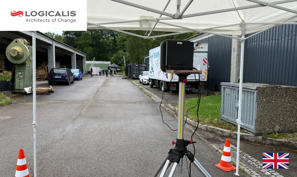
From Theory to Practice: Testing 5G Geo-Positioning in a Real-World Laboratory
Imagine rescue teams being able to share their location in real time even deep underground.After successful laboratory tests, we wanted to find out: Does the technology deliver under real-world conditions?
5G-Geopositionierung im Praxistest: Von der Theorie ins Real-Labor
Stellen Sie sich vor, Rettungskräfte könnten ihren Standort in Echtzeit teilen, selbst tief unter der Erde. Genau hier setzt die 5G-Geopositionierung an: Eine Technologie, die neue Maßstäbe in Präzision und Zuverlässigkeit setzt, selbst dort, wo GPS oder Radar an ihre Grenzen stoßen.

Documentation as the Key to Reliability and Transparency in Infrastructure Projects
In civil engineering projects such as fiber-optic rollouts, power grid expansion, or other utility infrastructure, documentation is often the invisible foundation that determines sustainable success.

Dokumentation als Schlüssel zu Zuverlässigkeit & Transparenz im Infrastruktur-Bereich
Wenn es um Tiefbauprojekte geht – sei es im Glasfaser-, Stromnetzausbau oder in Bauprojekten anderer Versorgungsleitungen, dann ist Dokumentation oft der unsichtbare Teil, der jedoch über nachhaltigen Erfolg entscheidet.

Germany , Jul 24, 2025
Gemeinsam zur grünen Energie! - Effiziente Netzplanungs-Unterstützung für Bayernwerk
Logicalis Connected übernimmt verschiedene Aufgaben im Rahmen der Planung und Realisierung von Trassenverläufen für Mittel- und Niederspannungsleitungen für Bayernwerk. Im Zuge des Übergangs zur grünen Energie im Rahmen der Energiewende werden zusätzliche Übertragungsleitungen zur Einspeisung benötigt.
Germany , Jun 27, 2025
Auf dem Weg zu Net Zero: Logicalis erreicht kohlenstoffneutralen Meilenstein
Logicalis, internationaler Anbieter von IT-Lösungen und Managed Services, hat sein Klimaziel für 2025 erreicht: die Kohlenstoffneutralität bei Scope-1- und Scope-2-Emissionen.
Germany , Apr 29, 2025
CIO Report 2025: CIOs kritisieren Security-Systeme als kostenintensiv und schwer zu managen
Logicalis, internationaler Anbieter von IT-Lösungen und Managed Services, stellt fest: CIOs fällt es angesichts der wachsenden Bedrohungslage zunehmend schwer, einen Nutzen aus ihren Sicherheitsinvestitionen zu ziehen.
Germany , Apr 17, 2025
Logicalis Deutschland: Rony Mikhael übernimmt Leitung der Business Unit Connectivity
Logicalis stärkt seine Führungsspitze in Deutschland und besetzt eine wichtige strategische Rolle neu: Rony Mikhael übernimmt ab sofort die Leitung der Business Unit Connectivity und verantwortet das Cisco-Geschäft des Unternehmens. Er folgt auf Stefan Gutekunst, der zum 1. Juni 2025 die Position des Managing Director Security bei Cisco Deutschland antreten wird.
Germany , Mar 24, 2025
„One Logicalis“: Logicalis, siticom und orange networks ab sofort unter einem Dach
Logicalis, internationaler Anbieter von IT-Lösungen und Managed Services, treibt die Stärkung seines Deutschlandgeschäfts weiter voran. Unter dem Motto „One Logicalis“ firmieren auch die Unternehmenstöchter siticom und orange networks ab sofort als Logicalis – unter gemeinsamer Führung mit der Logicalis GmbH.
Germany , Mar 17, 2025
Logicalis CIO Report 2025: Erfolg durch Innovation
Logicalis, internationaler Anbieter von IT-Lösungen und Managed Services, hat heute seinen jährlichen CIO Report veröffentlicht. Aus diesem geht hervor, dass 95 Prozent der Unternehmen aktiv in Technologien investieren, um innerhalb der nächsten zwölf Monate neue Einnahmequellen zu erschließen.
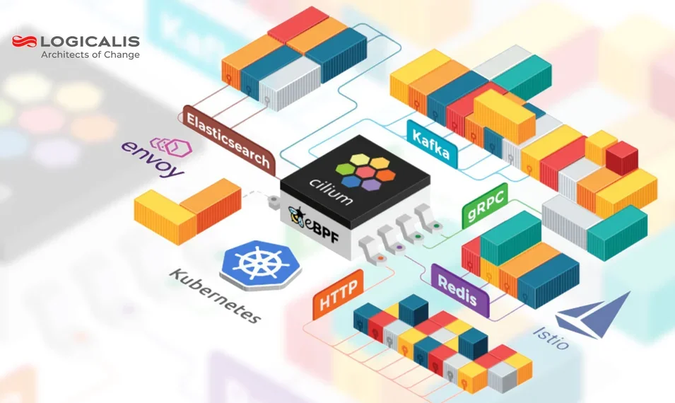
From SmartNICs to eBPF: How Logicalis Builds a Next-Gen Cilium Lab for Real-World Networking
#Hypershield. #SmartNIC offloading. #Cilium. #eBPF-based security. These technologies are reshaping modern enterprise networking – and not just for the hyperscalers. At Logicalis, we’re building a flexible, automated Cilium Lab to bring that power to customers of all sizes.
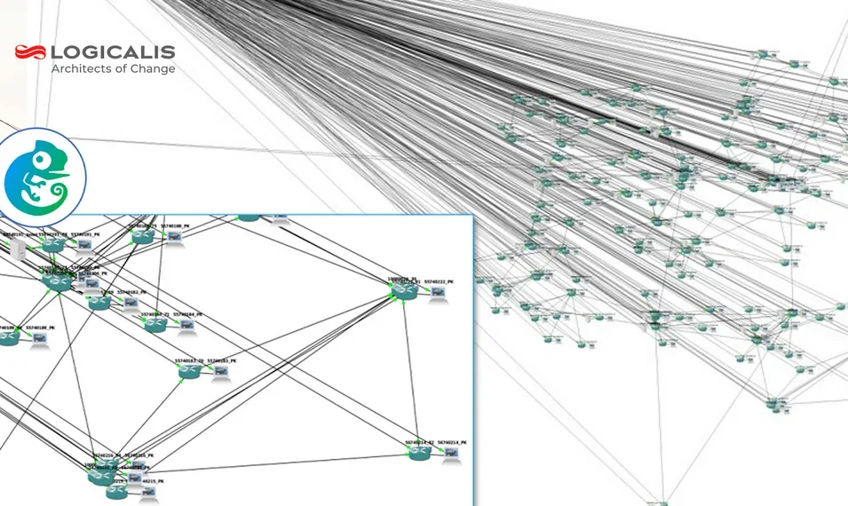
Digitaler Zwilling von Netzwerken: Simulationsgestützte Planung bei EWE Tel
Das kontinuierliche Wachstum des Datenverkehrs ist heutzutage eine echte Herausforderung für die Betreiber, da mehrere Dienste ihren Datenverkehr in die Betreiber Netze hinzufügen. Bei jeglicher Planung von Infrastruktur sind digitale Zwillinge ein wichtiges Hilfsmittel, um Kosten zu sparen und Schwierigkeiten und Konflikte vorherzusehen. Dies gilt auch für die Planung von Netzwerken.
MultiNet6G: Brücken bauen zwischen drahtlosen Technologien
Das MultiNet6G-Projekt wird von der Vision angetrieben, verschiedene drahtlose Kommunikationstechnologien nahtlos zu integrieren, darunter 5G, WiFi, Visible Light Communication (VLC) und Radarkommunikation. Der Bedarf für diese Integration ergibt sich aus mehreren Szenarien.

Logicalis und Currenta - Ein Interview zur Erfolgsgeschichte in der Campus-Umgebung
Unser Netzwerk-Design für Currenta steht exemplarisch für erfolgreiche Planung und Orchestrierung in einer komplexen Campus-Umgebung. Im Fokus steht das Currenta Backbone Projekt, bei dem ein IP-Datennetz für den CHEMPARK-Betreiber über drei Standorte hinweg implementiert wurde.
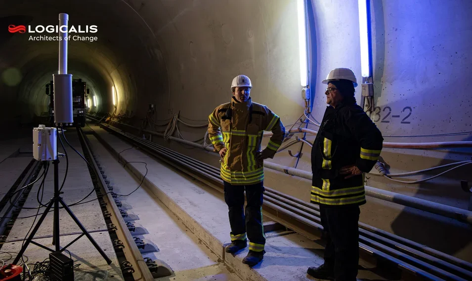
5G Mobil-Konnektivität in Europas Tunnelprojekten
In Europa erleben wir eine stetige Zunahme von Tunnelbauprojekten. Diese komplexen Untergrundprojekte stellen besondere Herausforderungen an die Kommunikation und Sicherheit, insbesondere für Rettungsdienste, für die eine zuverlässige Mission Critical Communication (MCC) unverzichtbar ist.

Network Source Of Truth (NSOT): Die Basis für Netzwerk Automation
Network Source of Truth (NSoT)-Systeme zentralisieren netzwerkbezogene Daten, vereinfachen die Verwaltung von Konfigurationen, IP-Adressen und Geräten und gewährleisten Datenkonsistenz und Effizienz im gesamten Unternehmen. Sie sind ein Baustein, aber kein Allheilmittel.
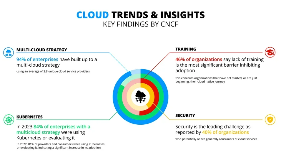
Cloud-Native Transformation und Platform Engineering im der FinTech: Legacy-Infrastruktur meistern
FinTech-Unternehmen müssen mit hohen Verarbeitungslasten, langsamen Bereitstellungszyklen und komplexem Kostenmanagement umgehen, während sie gleichzeitig Bare-Metal reduzieren und verteilte Infrastrukturen aufbauen. In diesem Artikel zeigen wir, wie FinTech-Unternehmen diese Hürden überwinden können, indem sie Cloud-native Technologien erfolgreich nutzen.
Germany , Dec 3, 2024
„One Logicalis“: Logicalis stärkt Deutschlandgeschäft
Logicalis, internationaler Anbieter von IT-Lösungen und Managed Services, bündelt sein Deutschlandgeschäft mit „One Logicalis“ unter einer neuen Struktur. Damit agieren die Unternehmen Logicalis GmbH, siticom GmbH sowie orange networks GmbH ab sofort unter einer einheitlichen Führung.
Germany , Nov 18, 2024
„Cybersicherheit ist keine rein technische Aufgabe mehr“
Die Lage der IT-Sicherheit in Deutschland war und ist besorgniserregend.“ Zu dieser Einschätzung kommt das Bundesamt für Sicherheit in der Informationstechnik (BSI) in seinem jährlichen Bericht zur Lage der IT-Sicherheit in Deutschland.
Germany , Nov 11, 2024
Logicalis bietet als erster globaler Partner Cisco XDR als Managed Service an
Logicalis, ein weltweit führender Anbieter digitaler Managed Services, bietet als erster globaler Cisco-Partner Cisco Extended Detection and Response (XDR) als Managed Service (MXDR) an.
Germany , Oct 29, 2024
Cisco Partner Summit 2024: Logicalis als globaler Nachhaltigkeitspartner des Jahres ausgezeichnet
Cisco Partner Summit 2024: Logicalis zum zweiten Mal in Folge als Global Sustainability Partner of the Year ausgezeichnet.
Germany , Sep 12, 2024
Logicalis gibt bedeutende Fortschritte bei der Erreichung der Nachhaltigkeitsziele bekannt
Logicalis, ein globaler Technologiedienstleister, hat im Logicalis Responsible Business Report 2024 bedeutende Fortschritte bei der Erreichung seiner Nachhaltigkeitsziele bekannt gegeben. Das Unternehmen meldete eine 27-prozentige Verringerung der Scope-1-Emissionen seit dem GJ22, während die marktbasierten Scope-2-Emissionen um 17 % reduziert wurden.
Germany , Jul 10, 2024
Logicalis erhält Status als Leader und zweifacher Rising Star für Netzwerk-Lösungen und -Services
Das internationale Marktforschungs- und Beratungshaus ISG (Information Services Group) stuft Logicalis als Leader im Bereich „Edge Technologies and Services (incl. Private 5G)“ sowie als Rising Star in den Bereichen „Managed SD-WAN-Services“ und „Secure Access Service Edge (SASE)“ für den deutschen Markt ein.
Germany , May 13, 2024
Logicalis erweitert seine globalen Security Services mit der Einführung von Intelligent Security
Logicalis, internationaler Anbieter von IT-Lösungen und Managed Services, führt mit Intelligent Security einen Blueprint-Ansatz für sein globales Sicherheitsportfolio ein. Ziel ist es, Kunden auf der ganzen Welt proaktive, fortschrittliche Sicherheit zu bieten.
Germany , Apr 22, 2024
Science Based Targets Initiative (SBTi) erkennt Logicalis Netto-Null-Emissionsziele an
Die Science Based Targets Initiative (SBTi) hat die klimawissenschaftlich fundierten Netto-Null-Ziele von Logicalis, einem internationalen Anbieter von IT-Lösungen und Managed Services, geprüft und anerkannt.
Germany , Mar 4, 2024
CIO-Bericht 2024: KI und Sicherheit sind oberste Prioritäten bei der herausfordernden Transformation
Logicalis, internationaler Anbieter von IT-Lösungen und Managed Services, hat heute zum zehnten Mal in Folge seinen jährlichen CIO Report veröffentlicht.
Germany , Feb 22, 2024
Branchentrends: durchgängige Sicherheitsstrategien und Managed Services im Fokus
Die Zahl der Cyber-Angriffe steigt ungebremst, insbesondere Ransomware-Attacken sind eine beliebte Taktik der Kriminellen. 47 Prozent der Unternehmen waren bereits Opfer einer solchen Attacke, über die Hälfte (61 Prozent) sogar mehr als einmal.
Germany , Jan 16, 2024
Logicalis: Markus Stotz ist neuer Chief Financial Officer
Markus Stotz ist seit dem 15. Januar 2024 neuer Chief Financial Officer bei Logicalis, internationaler Anbieter von IT-Lösungen und Managed Services.
Germany , Nov 9, 2023
Cisco Partner Summit 2023: Logicalis als Global Sustainability Partner of the Year ausgezeichnet
Logicalis, internationaler Anbieter von IT-Lösungen und Managed Services, wurde auf dem Cisco Partner Summit 2023 zum Sustainability Partner of the Year ernannt.
Germany , Sep 11, 2023
Logicalis erweitert sein Angebot an Cisco-powered Managed Services mit der Einführung von Intelligent Connectivity
Logicalis, internationaler Anbieter von IT-Lösungen und Managed Services, gibt die Einführung von „Intelligent Connectivity powered by Cisco“ bekannt. Die Lösungs-Suite umfasst Private 5G, SD-WAN, SASE/SSE, SD-Access und ACI Data Centre.
Germany , Jul 5, 2023
Use Cases erlebbar machen: Logicalis schafft mit Private 5G Labs kundenspezifische Anwendungsfälle zum Anfassen
Logicalis, internationaler Anbieter von IT-Lösungen und Managed Services, baut sein Angebot im Bereich Private 5G weiter aus.
Germany , Jun 28, 2023
Logicalis erneuert Status als Cisco Global Gold Integrator
Als einer von nur sechs Cisco Global Gold Certified Partnern: Logicalis liefert Innovation, Engagement und Mehrwert für Kunden weltweit
Germany , May 31, 2023
Datenbankmigration leicht gemacht: Logicalis zeigt mit Atroposs, wie es geht
Logicalis, internationaler Anbieter von IT-Lösungen und Managed Services, stellt mit Atroposs eine neue Lösung für Cloud-Migrationsvorhaben im Datenbankkontext vor.
Germany , May 23, 2023
Logicalis: Deutschland-Zentrale bezieht neue Räumlichkeiten in Neu-Isenburg
Logicalis, internationaler Anbieter von IT-Lösungen und Managed Services, hat mit seiner Deutschland-Zentrale zum 16. Mai 2023 neue, moderne Räumlichkeiten in Neu-Isenburg bei Frankfurt am Main bezogen.

Fallstudie gkv informatik: IT-Dienstleister gesetzlicher Krankenversicherungen
Als IT-Dienstleister unterstützt die gkv informatik GbR (gkv informatik) ihre Gesellschafter, die gesetzlichen Krankenversicherungen (GKV), bei IT-gestützten Services für die insgesamt rund 17 Millionen Versicherten und die mehr als 38.000 GKV-Mitarbeitenden.
Germany , Mar 21, 2023
Logicalis als NetApp Growth Partner of the Year ausgezeichnet
Logicalis, internationaler Anbieter von IT-Lösungen und Managed Services, hat den NetApp EMEA & LATAM Partner Award 2023 in der Kategorie Growth Partner of the Year gewonnen.
Germany , Feb 20, 2023
Veränderte Führungsqualitäten bringen CIOs in die Vorstandsetagen
Laut der Global CIO Survey 2023 von Logicalis, internationaler Anbieter von IT-Lösungen und Managed Services, haben CIOs die Rolle des digitalen „Evangelisten“ und strategischen Beraters eingenommen.
Germany , Jan 20, 2023
Doppelter Erfolg: Logicalis erhält zweifachen Leadership-Status im Oracle Ecosystem
Das internationale Marktforschungs- und Beratungshaus ISG (Information Services Group) stuft Logicalis als Leader in den Bereichen „Consulting and Strategy Services“ sowie „Implementation and Integration Services“ für den deutschen Markt ein.
Germany , Dec 19, 2022
Weiterer Meilenstein auf dem Weg zur Nachhaltigkeit
Logicalis, weltweiter Anbieter von IT-Services, gibt sein Engagement für den Corporate Net-Zero Standard der Science Based Targets Initiative (SBTi) bekannt – den weltweit ersten Handlungsrahmen für Unternehmen zur Festlegung von Net-Zero-Zielen im Einklang mit der Klimawissenschaft.
Germany , Sep 7, 2022
Logicalis erhält ISG-Auszeichnung als Leader Enterprise Networks Technology and Service Suppliers
Das internationale Marktforschungs- und Beratungshaus ISG (Information Services Group) stuft Logicalis als Leader im Bereich „Enterprise Networks Technology and Service Suppliers“ für den deutschen Markt ein.
Germany , Jul 5, 2022
Nachhaltigkeit in der IT: Logicalis ist Cisco Environmental Sustainability Specialist
Logicalis hat im Rahmen des Cisco-Partnerprogramms die Cisco Environmental Sustainability Spezialisierung erlangt. Damit erfüllt der Anbieter von IT-Lösungen und Managed Services die Bedingungen, um Kunden bei der Umstellung auf nachhaltiges Wirtschaften zu helfen und sie bei der Rückführung und dem Recycling von ausgedienter Hardware zu unterstützen.
Germany , Jun 14, 2022
Klaus Goldbach zum neuen Geschäftsführer der orange networks GmbH ernannt
Klaus Goldbach ist seit dem 1. Juni neuer Geschäftsführer der orange networks GmbH. Er tritt damit die unmittelbare Nachfolge von Matthias Seitle und Uwe Scheuber an, die bisher gemeinschaftlich die Geschäftsführung verantwortet haben.
Germany , May 3, 2022
Hannover Messe 2022: Logicalis zeigt Einsatzmöglichkeiten von Private-5G-Technologien am Cisco-Stand
Die Logicalis GmbH stellt auf der Hannover Messe (30. Mai - 2. Juni in Hannover) innovative Private-5G-Technologien vor (Cisco Stand: Halle 5, Stand D36). „5G ermöglicht als wegweisender Kommunikationsstandard für Unternehmen die Nutzung neuer Services und fördert damit auch die Entstehung neuartiger Geschäftsmodelle“, sagt Stefan Höltken, Managing Director bei der siticom GmbH.
Germany , Apr 25, 2022
Mit Netzwerk-Konnektivität für die Zukunft gerüstet: Logicalis kündigt Managed Intelligent Connectivity Service an
Logicalis, weltweiter Anbieter von IT-Lösungen und Managed Services, kündigt heute die Einführung des Managed Intelligent Connectivity Services an. Dabei handelt es sich um eine Lösung, die es Kunden mit einer digitalen Vorreiterrolle ermöglichen soll, ihre Geschäftsperformance und Benutzererfahrung zu verbessern, indem sie Netzwerk-Konnektivität als Managed Service beziehen.
Christian Werner im Interview: Kreativität mit technischer Expertise verbinden
In der derzeitigen Ausgabe von IT-Director, einem führenden IT-Magazin, finden Sie das Cover-Interview mit unserem CEO Christian Werner.
Germany , Mar 16, 2022
Logicalis baut Präsenz im DACH-Raum aus
Logicalis, weltweiter Anbieter von IT-Lösungen und Managed Services, erweitert den Aufgabenbereich von Christian Werner. Der bisherige CEO der Logicalis in Deutschland zeichnet ab sofort als CEO Logicalis für den gesamten DACH-Raum verantwortlich.
Germany , Mar 14, 2022
Logicalis ernennt Damian Skendrovic zum CEO EMEA
Logicalis, weltweiter Anbieter von IT-Lösungen und Managed Services, hat Damian Skendrovic mit sofortiger Wirkung zum CEO für die EMEA-Region ernannt.

Paragon Data setzt auf leistungsfähigen zentralen Storage
Die Leistungen von Paragon Data erstrecken sich dabei vom Betrieb eines eigenen Hochsicherheits-Rechenzentrums bis hin zur Entwicklung von Applikationen.
Germany , Feb 10, 2022
Optimierung und Automatisierung von Cloud-Infrastrukturen
Logicalis, weltweiter Anbieter von IT-Lösungen und Managed Services sowie langjähriger NetApp Partner, bietet seit kurzem mit Spot by NetApp eine umfassende Lösung zur Optimierung von Cloud-Infrastrukturen.
Germany , Jan 20, 2022
Alles aus einer Hand: Logicalis als Microsoft Cloud Solution Provider zertifiziert
Logicalis hat kürzlich den Status Microsoft Cloud Solution Provider (CSP) erlangt. Somit kann der weltweite Anbieter von IT-Lösungen und Managed Services seinen Kunden nun auch den direkten Zugang zu Microsoft Cloud Services wie Azure oder Microsoft 365 anbieten.
Germany , Jan 9, 2022
Logicalis hebt digitalen Arbeitsplatz auf neues Level
Logicalis, weltweiter Anbieter von IT-Lösungen und Managed Services, kündigt heute die Einführung seiner Lösung für den digitalen Arbeitsplatz an, die Unternehmen bei der Verwaltung, Verbesserung und Skalierung der Zusammenarbeit am digitalen Arbeitsplatz unterstützen soll.
Germany , Dec 9, 2021
Great Place to Work®: Logicalis erhält Auszeichnung als „Attraktiver Arbeitgeber“
Das internationale Forschungs- und Beratungsinstitut Great Place to Work® hat Logicalis als „Attraktiven Arbeitgeber“ ausgezeichnet. Das Zertifizierungsprogramm würdigt den internationalen Anbieter von IT-Lösungen und Managed Services damit als Arbeitgeber, der sich in besonders hohem Maße bei der Gestaltung der Arbeitsplatzkultur und Arbeitgeberattraktivität engagiert.
Germany , Oct 28, 2021
Logicalis unterzeichnet „Charta der Vielfalt“
Logicalis hat die „Charta der Vielfalt“ unterzeichnet. Damit verpflichtet sich der weltweite Anbieter von IT-Lösungen und Managed Services dazu, Vielfalt durch konkrete Maßnahmen zu fördern, sich für Inklusion, Gleichstellung und Zusammenarbeit einzusetzen und Diversität als festen Bestandteil in der Unternehmenskultur zu etablieren.
Germany , Oct 21, 2021
Logicalis CIO-Studie: IT-Verantwortliche sind verstärkt Treiber der geschäftlichen Transformation
Weltweit sind sich viele Unternehmen ihrer aktuellen Herausforderungen in puncto digitaler Transformation bewusst, ergreifen aber nicht immer effektive Maßnahmen, um diese anzugehen. Laut der „Logicalis Global Survey 2021-2022“ rücken IT-Verantwortliche dabei verschärft als Innovationstreiber in den Mittelpunkt der geschäftlichen Transformation – mit Fokus auf die Bereiche Service-Innovationen, effektive Datennutzung und Cyber-Risiken.
Germany , Oct 18, 2021
Logicalis gestaltet mit der weltweiten Einführung von Secure OnMesh den traditionellen Ansatz für Enterprise Security neu
Logicalis, weltweiter Anbieter von IT-Lösungen und Managed Services, hat heute die Markteinführung seiner neuen Sicherheitslösung Secure OnMesh angekündigt.
Germany , Oct 7, 2021
Logicalis bei den NetApp EMEA & LATAM Partner Awards als EMEA Hybrid Cloud Partner of the Year ausgezeichnet
Logicalis, internationaler Anbieter von IT-Lösungen und Managed Services, hat kürzlich den NetApp Partner Award als EMEA Hybrid Cloud Partner of the Year gewonnen. NetApp, ein globales cloud- und datenorientiertes Softwareunternehmen, vergibt diese Auszeichnungen jährlich als Anerkennung für getätigte Investitionen und Zusammenarbeit mit seinen wichtigsten Partnern.
Germany , Oct 5, 2021
Logicalis tritt Microsoft Intelligent Security Association bei
Logicalis, weltweiter Anbieter von IT-Lösungen und Managed Services, ist der „Microsoft Intelligent Security Association“ (MISA) beigetreten. Die MISA ist ein Zusammenschluss unabhängiger Software-Anbieter und Managed Security Service Provider, die Sicherheitslösungen integrieren, um Kunden gegen die zunehmenden Bedrohungen im IT-Umfeld zu wappnen.
Germany , Aug 19, 2021
Neue Experten an Bord: Logicalis stärkt Cloud Business und Vertriebsorganisation
Logicalis hat mit Uwe Scheuber als Head of Microsoft Business Germany und Michael Carstens als Manager Commercial Sales zwei neue Experten im Team. Der internationale Anbieter von IT-Lösungen und Managed Services stärkt damit das Geschäftsfeld Cloud Business sowie die Vertriebsorganisation und treibt seinen Wachstumskurs weiter voran.
Germany , Aug 12, 2021
Compliance in der Cloud: Alle Ebenen absichern
Cloud-Umgebungen gewinnen schnell an Komplexität – insbesondere dann, wenn Fachabteilungen spezifische Cloud-Services nutzen. Für Unternehmen gilt es daher mehr denn je, den Überblick zu behalten und die Einhaltung geltender Regularien und Compliance-Vorgaben sicherzustellen.
Rieck stellt sich mit neuer IT-Infrastruktur zukunftssicher auf
Die Rieck-Gruppe bietet als familiengeführtes Unternehmen mit circa 700 Mitarbeitern passgenaue Lösungen rund um Transport und Logistik.
Germany , Jun 24, 2021
Logicalis erhält ISG-Auszeichnung als Leader im Bereich SDx
Das internationale Marktforschungs- und Beratungshaus ISG (Information Services Group) stuft Logicalis, weltweiter Anbieter von IT-Lösungen und Managed Services, als Leader im Bereich „Technology and Service Suppliers (Core – 4G/5G)“ für den deutschen Markt ein.
Germany , Jun 2, 2021
Logicalis übernimmt Netzwerkinfrastruktur- und 5G-Spezialisten siticom
Logicalis, internationaler Anbieter von IT-Lösungen und Managed Services, übernimmt mit sofortiger Wirkung die siticom GmbH, den Spezialisten für Netzwerktransformation und -modernisierung. Durch die Investition stärkt Logicalis sein Angebot im Bereich der Software Defined Services, um Kunden die Vernetzung von Menschen und Geräte zu ermöglichen.
Germany , May 25, 2021
Logicalis: Mit der Production Ready Cloud schnell und sicher in die Cloud
Logicalis, internationaler Anbieter von IT-Lösungen und Managed Services, hat mit der Production Ready Cloud (PRC) einen standardisierten Cloud-Baukasten entwickelt, mit dem Unternehmen den Weg in die Cloud zuverlässig und strukturiert beschreiten können.
Germany , May 19, 2021
Logicalis ist Oracle Cloud Partner of Choice für europäische OCRE-Ausschreibung
Logicalis, internationaler Anbieter von IT-Lösungen und Managed Services sowie Mitglied des Oracle-Partnernetzwerks (OPN), wurde als Oracle Cloud Partner of Choice für das Open Clouds for Research Environments (OCRE) Framework in Deutschland und Irland ausgewählt.
Germany , May 12, 2021
Logicalis Group: Toby Alcock wird Chief Technology Officer
Logicalis, internationaler Anbieter von IT-Lösungen und Managed Services, hat Toby Alcock zum Chief Technology Officer der Logicalis Group ernannt. Alcock bekleidete zuletzt die Position des Chief Technology Officer für Logicalis Australien. Seine Ernennung erfolgt nach einem starken Wachstumsjahr von Logicalis.

Eine Privatbank wechselt ins Homeoffice: Donner & Reuschel machts mit Azure Virtual Desktop möglich
Das Bankhaus DONNER & REUSCHEL bietet maßgeschneiderte Lösungen für eine anspruchsvolle Klientel: Unternehmer, Private-Banking-Kunden, Institutionelle Anleger, Immobilienkunden und Capital-Markets-Kunden.
Germany , Dec 21, 2020
Die Logicalis Group ernennt Michael Chanter zum Chief Operating Officer
Die Logicalis Group ernennt Michael Chanter - CEO von Thomas Duryea Logicalis in Australien - zum Chief Operating Officer.
Germany , Oct 6, 2020
Logicalis bietet mit Azure NetApp Files effiziente File Services aus der Cloud
Als einer der ersten Partner bietet Logicalis, internationaler Anbieter von IT-Lösungen und Managed Services, mit Azure NetApp Files eine Storage-Lösung, mit der Unternehmen schnell auf große Datenmengen zugreifen können.
Zukunftssicher aufgestellt dank Oracle Cloud Infrastructure
Die PlanetHome Group mit Hauptsitz in München/Unterföhring ist einer der führenden Immobiliendienstleister in Deutschland und Österreich.
Germany , Jun 4, 2020
Logicalis startet digitale Service-Plattform: KI-Innovationen reduzieren Ausfälle und erhöhen digitale Sicherheit
Die Logicalis Group, internationaler IT-Lösungs- und Managed Services Provider, hat heute den Start einer neuen digitalen Service-Plattform (DSP) bekanntgegeben, die auf Basis künstlicher Intelligenz arbeitet und Artificial Intelligence Operations (AIOps) einsetzt.
Germany , Apr 14, 2020
Logicalis ist Titanium-Partner im Dell Technologies Partnerprogramm
Die Logicalis GmbH hat den Titanium-Status im Dell Technologies Partnerprogramm erlangt.
Germany , Mar 17, 2020
Logicalis Verhaltenscodex im Umgang mit dem Coronavirus
Die Mitarbeiter*innen, Kunden und Partner stehen immer im Zentrum unseres Handelns. Deshalb haben wir uns vor dem Hintergrund der aktuellen Situation rund um Corona (COVID-19) entschieden, verschiedene Maßnahmen zu ergreifen, die dem Schutz am Arbeitsplatz und der Sicherstellung des Betriebs dienen.
Germany , Mar 5, 2020
Logicalis ist Microsoft Azure Expert Managed Service Provider
Logicalis ist Microsoft Azure Expert Managed Service Provider.
Germany , Feb 19, 2020
Logicalis CIO-Studie: Unternehmen könnten Vorteile bei der Anwendung neuer Technologien besser nutzen
In der „Global CIO Survey 2019“ von Logicalis gaben 61 Prozent der insgesamt 888 befragten CIOs an, dass ihre Unternehmen heute Internet of Things-Technologien (IoT) nutzen.
Germany , Feb 5, 2020
„Architects of Change“: Logicalis positioniert sich neu
„Architects of Change“: Logicalis positioniert sich neu. Neuer Markenauftritt rückt Digitalisierungskompetenz in den Fokus.
Germany , Jan 16, 2020
Logicalis CIO-Studie: Druck auf IT-Verantwortliche steigt weltweit
CIOs weltweit nehmen in den Unternehmen eine immer größere strategische Rolle ein und werden verstärkt am Umsatzwachstum gemessen.
Germany , Jan 9, 2020
Cisco Live EMEA 2020: Logicalis gibt Impulse für mehr Agilität in IT-Infrastrukturen
Logicalis präsentiert auf der kommenden Cisco Live EMEA (27. bis 31. Januar 2020, Barcelona) am Stand 52 sein Portfolio für die Modernisierung von IT-Landschaften.

Fallstudie: AirIT setzt Zeichen für Wachstum dank durchdachter Oracle Lizenzoptimierung
Die Fraport AG zählt zu den international führenden Unternehmen im Airport-Business und ist an 30 Flughäfen auf vier Kontinenten aktiv.

Fallstudie: socoto beschleunigt die Bereitstellung von Marketing Software mit HCI
Die socoto gmbh & co. kg mit Sitz in Trier entwickelt und hostet seit bereits 20 Jahren Marketing Management Software in Kombination mit individuellen Servicelösungen für ihre nationalen und internationalen Kunden.
Germany , Nov 12, 2019
Cisco Partner Summit 2019: Logicalis erhält weitere europäische und deutsche Auszeichnungen
Logicalis, internationaler IT-Solutions- und Managed-Services-Anbieter, erhielt auf dem Cisco Partner Summit 2019 (Las Vegas, Nevada/USA) weitere Auszeichnungen für den europäischen und deutschen Markt.
Germany , Nov 6, 2019
Logicalis Europe auf Cisco Partner Summit 2019 mit dem Global Award als IoT Industry Partner of the Year ausgezeichnet
Die Logicalis Group, internationaler IT-Solutions- und Managed-Services-Anbieter und einer von fünf Cisco Gold Partnern, hat diese Woche auf dem Cisco Partner Summit 2019 (Las Vegas, Nevada/USA) den Cisco® Partner Summit Global Award als IoT Industry Partner of the Year erhalten.
Germany , Oct 1, 2019
Logicalis ist Leader im IDC MarketScape Report “Worldwide Network Consulting Services Vendor Assessment"
Die Logicalis Group, internationaler Anbieter von IT-Lösungen und Managed Services, hat heute bekanntgegeben, dass sie von IDC im MarketScape: “Worldwide Network Consulting Services Vendor Assessment“ als Leader positioniert wurde.
Germany , Sep 3, 2019
Logicalis GmbH übernimmt Microsoft Gold Partner Orange Networks GmbH
Internationaler IT-Solutions- und Managed-Services-Anbieter verstärkt Hybrid-Cloud-Angebot.
Germany , Aug 14, 2019
Logicalis übernimmt Team für Cisco Industrial Networking von Hopf
Führender IT-Solutions und Managed-Service-Anbieter investiert in Industrial Internet of Things (IIoT).
Germany , Jul 25, 2019
Zukunftsorientierte Managed Services: John Kennard ist neuer Director Service Excellence & Delivery der Logicalis GmbH
John Kennard hat zum 1. Juli dieses Jahres die Verantwortung für den Bereich Service Excellence & Delivery der Logicalis GmbH übernommen.
Germany , May 28, 2019
Logicalis mit NetApp EMEA Partner Excellence Award 2019 ausgezeichnet
Logicalis Deutschland erhielt die Auszeichnung als Flash Partner of the Year EMEA für die hervorragende Leistung und ein dreistelliges Wachstum mit NetApp‘s Flash-Technologie im zurückliegenden NetApp Geschäftsjahr.
Germany , May 21, 2019
Application Performance Management: Engpässe und Probleme erkennen und vermeiden
Unternehmen verwenden in der softwaregetriebenen und zunehmend digitalisierten Welt immer häufiger komplexe Anwendungen. Die Anforderungen an Ausfallsicherheit und Performance steigen entsprechend, beispielsweise in puncto Reaktionszeiten.
Germany , May 7, 2019
Endpoint Security: 5 Kriterien für umfassende Endpunkt-Sicherheit in Unternehmen
Logicalis erläutert in seinem neuen Ratgeber Endpoint Security wichtige Kriterien einer umfassenden Endpoint-Security-Strategie.
Germany , Mar 26, 2019
Logicalis GmbH erhält DIN ISO/IEC 27001 Zertifizierung für Informationssicherheits-Managementsystem
Die Logicalis GmbH wurde für ihr Informationssicherheits-Managementsystem (ISMS) vom TÜV Rheinland nach ISO 27001 zertifiziert.
Germany , Mar 14, 2019
Hannover Messe 2019: Logicalis präsentiert smarte IoT-Infrastrukturen am Cisco-Stand
Die Logicalis GmbH, internationaler IT-Lösungs- und Managed Services Provider, zeigt auf der Hannover Messe (1.-5. April 2019, Hannover), wie Unternehmen und der öffentliche Sektor zukunftsfähige IoT-Infrastrukturen aufbauen, gestalten und managen können.
Germany , Feb 20, 2019
Logicalis erhält den Cisco IoT Authorisation Partner Status
Logicalis, der internationale Anbieter von IT-Lösungen und Managed Services, wurde als eine der ersten Organisationen mit dem Cisco IoT Authorisation Partner Status ausgezeichnet.
Germany , Jan 29, 2019
HR im Zeichen der Digitalisierung: Dr. Stella Malsy ist neue HR-Direktorin der Logicalis GmbH
Dr. Stella Malsy, Human Resources Expertin, ist seit Januar dieses Jahres neue HR-Direktorin der Logicalis GmbH.
Germany , Jan 21, 2019
Neue Technologien: Deutschland muss aufholen
CIO-Studie von Logicalis beleuchtet den Einsatz von Business Intelligence, Analytics, IoT und KI.
Germany , Dec 13, 2018
Logicalis Studie: Rolle des CIOs wird strategischer
Rolle des CIOs wird strategischer Unternehmen lagern vermehrt aus und setzen auf Security, BI sowie Analytics
Germany , Nov 29, 2018
Logicalis ist Cisco Data Center Partner des Jahres
Logicalis ist von Cisco zum „Architectural Excellence Partner of the Year: Data Center” in Deutschland gekürt worden.
Germany , Nov 5, 2018
Logicalis GmbH stärkt Digitalisierungsexpertise: Murat Peker wird Director Sales Central & South West
Murat Peker wird Director Sales Central & South West
Germany , Oct 29, 2018
Logicalis mit Oracle Global Excellence Award ausgezeichnet
Logicalis wurde von Oracle mit dem Excellence Award als „Specialized Partner of the Year 2018 – Global in Engineered Systems” ausgezeichnet.
Germany , Oct 18, 2018
Cloud Expo Europe 2018: Logicalis präsentiert Cloud-Anwendungsfälle
Die Logicalis GmbH stellt auf der Cloud Expo Europe verschiedene Einsatzbereiche von Cloud Services vor.
Germany , Sep 27, 2018
it-sa 2018: Logicalis präsentiert umfassende IT-Security-Lösungen und Managed Services gegen Cyberattacken
Logicalis präsentiert Cloud-basierte Lösungen zur Abwehr komplexer Bedrohungen!
Germany , Sep 20, 2018
Logicalis und AppDynamics geben Partnerschaft bekannt
Die Logicalis GmbH, IT-Lösungs- und Managed Services-Anbieter, kooperiert im Bereich Applikationen künftig mit AppDynamics Inc.
Germany , Sep 13, 2018
6 Punkte auf dem Weg zum digitalen Business
Der international operierende IT-Dienstleister Logicalis beschreibt in seinem Whitepaper „6 Punkte für den Weg zum digitalen Business“ wesentliche Erfolgsfaktoren für die Digitalisierung von Geschäftsmodellen.
Germany , Sep 3, 2018
Logicalis akquiriert Clarotech Managed Services
Die Logicalis Group gibt die Akquisition von Clarotech, eines IP-Telefonie (IPT) Cloud und Managed Services Anbieters mit Sitz in Kapstadt (Südafrika), bekannt.
Germany , Aug 16, 2018
Andreas Richter ist Director Corporate Communications der Logicalis GmbH
Andreas Richter ist Director Corporate Communications der Logicalis GmbH
Germany , Aug 9, 2018
Logicalis bietet Orientierung im Markt für hyperkonvergente Systeme
Unter Leitung von Markus Hahn (30) legt die im April gegründete Practice „Data Center“ der Logicalis GmbH nun mit einem spezialisierten Team besonderes Augenmerk auf hyperkonvergente Infrastrukturen (HCI, Hyper Converged Infrastructure).

Germany , Jul 25, 2018
Optimierung des Storage-Systems für die Klüh Service Management GmbH
Die Klüh Service Management GmbH ist internationaler Multiservice-Anbieter für Einzeldienstleistungen und Servicekonzepte.
Germany , Jun 19, 2018
Stefan Mulder wird bei der Logicalis GmbH Sales Director für Security
Stefan Mulder (50) verantwortet seit dem 1. April 2018 als Sales Director Security den Bereich Security der Logicalis Group in Deutschland.
Germany , May 15, 2018
Peter Koch neuer CTO der Logicalis GmbH
Neuer CTO der Logicalis GmbH wird Peter Koch.
Germany , Apr 25, 2018
Inforsacom Logicalis GmbH schärft Organisationsstruktur
Practice-Leader verjüngen das Management
Germany , Apr 9, 2018
Umfirmierung: Inforsacom Logicalis GmbH wird zur Logicalis GmbH
Umfirmierung: Inforsacom Logicalis GmbH wird zur Logicalis GmbH
Germany , Nov 16, 2017
CIO-Umfrage: Legacy-IT behindert digitalen Wandel
Logicalis Studie zeigt, dass IT-Chefs zu Gestaltern und nicht Verwaltern des Wandels werden wollen.
Germany , Jul 31, 2017
Inforsacom Logicalis ist Veritas Best New Partner EMEA 2017
Inforsacom Logicalis ist Veritas Best New Partner EMEA 2017 Steigerung des Neugeschäfts um 76 Prozent!
Germany , Jul 4, 2017
Logicalis Group stärkt Security Operations Centre Europe
Mehr Cyber-Attacken: Nachfrage nach IT-Security-Lösungen wächst
Germany , May 11, 2017
Inforsacom Logicalis investiert in neuen Berliner Standort
Inforsacom Logicalis investiert in einen neuen Berliner Standort
Germany , May 5, 2017
Modernes Datacenter für die Universität zu Köln
Die Universität zu Köln zählt mit mehr als 47.000 Studierenden zu den größten Hochschulen Europas; die Anforderungen an die Administration sind entsprechend hoch.
Germany , Apr 18, 2017
Inforsacom Logicalis ist Platinum Partner im Dell EMC Partnerprogramm
Die Inforsacom Logicalis GmbH wird im Dell EMC Partnerprogramm ab sofort als Platinum Partner geführt.
Germany , Apr 13, 2017
HANNOVER MESSE: Inforsacom Logicalis berät als Mitglied der Innovation Alliance zum Thema Digitalisierung
Die Inforsacom Logicalis GmbH, serviceorientierter IT-Lösungs- und Managed Services-Anbieter mit Hauptsitz in Frankfurt am Main, ist vom 24. bis 28. April 2017 als Mitglied der Innovation Alliance auf der HANNOVER MESSE vertreten.
Germany , Feb 28, 2017
Inforsacom Logicalis ist Mitglied der Innovation Alliance
Die Inforsacom Logicalis GmbH engagiert sich als Lösungs- und Managed Services-Anbieter in der Innovation Alliance. Von Cisco mit 11 Unternehmen aus der IT-Branche gegründet, soll die Kooperation das Thema Digitalisierung im Mittelstand vorantreiben.
Germany , Feb 21, 2017
Inforsacom Logicalis erhält Oracle Excellence Award
Im Rahmen des Oracle Open Days in Frankfurt am Main erhielt die Inforsacom Logicalis GmbH den Oracle Excellence Award Specialized Partner of the Year 2016 „Platform as a Service“ für den deutschen Markt.
Germany , Jan 30, 2017
Leitfaden für die Oracle Datenbankserver-Architektur
Das Thema Oracle Datenbankserver-Architektur ist sehr umfangreich – und für moderne Unternehmen ein sehr wichtiges dazu.
Germany , Nov 23, 2016
Christian Werner wird CEO der Logicalis Group in Deutschland
Die Logicalis Group verstärkt im Januar 2017 unter Leitung von Christian Werner ihre Aktivitäten in Deutschland. Der neue CEO wird das Deutschland-Geschäft des internationalen IT-Systemhauses leiten.
Germany , Nov 21, 2016
Logicalis Group ernennt neuen CFO für Deutschland
Logicalis Group ernennt neuen CFO für Deutschland.
Germany , Nov 2, 2016
Logicalis veröffentlicht globale CIO-Umfrage 2016
Logicalis globale CIO-Umfrage 2016: Dezentralität, Schatten-IT und Sicherheit sind wesentliche Themen für IT-Chefs.
Germany , Oct 13, 2016
Rüdiger Rath wird Europa-Chef von Logicalis
Rüdiger Rath wird Europa-Chef von Logicalis
Germany , Oct 9, 2016
ChannelPartner veröffentlicht Interview mit Deutschland CEO Rüdiger Rath
„2020 wollen wir unter die Top 10“ so titelt ChannelPartner in einem aktuellen Interview mit dem CEO der Logicalis-Group in Deutschland. Rüdiger Rath stellte sich den Fragen von Chefredakteur Dr. Ronald Wiltscheck und zeigt wohin die Reise des neu aufgestellten Unternehmens gehen soll.
Germany , Aug 4, 2016
Einziger NetApp-Partner mit Multi Geo Status
Inforsacom Logicalis erhält Multi Geo Status als einziger NetApp-Partner in Deutschland.
Germany , Jul 20, 2016
Ansgar Heitzig wird Head of Corporate Communications der Logicalis Group in Deutschland
IT-Lösungs- und Managed Services-Anbieter holt Strategieberater Ansgar Heitzig an Bord.
Germany , Jul 4, 2016
Die Logicalis Group nimmt deutschen Markt ins Visier
Die Logicalis Group nimmt deutschen Markt ins Visier. Mit der Inforsacom Logicalis GmbH entsteht ein schlagkräftiges IT-Systemhaus.
Germany , Jun 23, 2016
Inforsacom Logicalis NetApp Ontap-Partner des Jahres
Inforsacom Logicalis ist NetApp Ontap-Partner des Jahres.
Germany , May 4, 2016
Referenz PARI Medical Holding
Vision der PARI Medical Holding GmbH ist es, den Menschen, die an Atemwegserkrankungen leiden und denen, die sich um sie sorgen und kümmern, das Leben zu erleichtern.
Germany , May 4, 2016
Fuchs Petrolub SE
Die strategische Applikation bei Fuchs Petrolub für alle Konzernbereiche ist SAP. Dafür setzt Fuchs Petrolub seit 1998 die Oracle Datenbank ein.
Germany , May 3, 2016
Lizenz-Bestandsaufnahme und -Konsolidierung sowie Re-Design der Systemarchitektur
Die geplante Ausgründung eines Tochter unternehmens war für die EDAG-Gruppe ein Anlass, ihre Oracle-Lizenzen genauer unter die Lupe zu nehmen.
Germany , Apr 20, 2016
Frank Haines wird neuer CSO bei inforsacom Informationssysteme GmbH
Frank Haines wird neuer CSO bei inforsacom Informationssysteme GmbH
Germany , Oct 22, 2015
Ein attraktives gehostetes WLAN am Nürburgring
Der Nürburgring, die weltbekannte Traditions-Rennstrecke in der Eifel, ist längst nicht mehr „nur“ Anlaufpunkt für Motorsportfreunde, sondern fungiert darüber hinaus als Business- und Freizeitzentrum.
Germany , Oct 22, 2015
Gelebte Innovation für erfolgreiche Konsolidierung
Um die Komplexität der IT-Infrastruktur und so den Administrationsaufwand zu senken, legte Weleda AG Ende 2013 ein Konsolidierungsprojekt auf Kiel. Dabei setzte Weleda auch auf die enge Zusammenarbeit mit Logicalis.
Germany , Oct 22, 2015
Referenz Sirona Dental Systems
Im Jahr 2012 ließ Sirona die Lizenzsituation des Unternehmens durch den Oracle Platinum-Partner Logicalis und Oracle License Management Services (LMS) überprüfen.
Germany , Oct 6, 2015
Ein neues Netzwerk für die Berliner Philharmoniker
Die 1882 gegründeten „Berliner Philharmoniker“, eines der weltweit führenden Sinfonieorchester-Ensembles, sind seit 2002 als Stiftung des öffentlichen Rechts unter Trägerschaft des Landes Berlin organisiert.

Germany , May 3, 2015
DAT: Eindrucksvoll gesteigerte Performance, Skalierbarkeit und Zuverlässigkeit
Die Deutsche Automobil Treuhand (DAT) bietet allen relevanten Playern der Automobilbranche systematisch aufbereitete Informationen über nahezu den gesamten Lebenszyklus von Kraftfahrzeugen.
Germany , Apr 16, 2015
IT-Unternehmen inforsacom Informationssysteme und Logicalis GmbH unter gemeinsamer Leitung
Köln, 16.04.2015 - Am 1. März 2015 hat Rüdiger Rath die Rolle als General Manager der Inforsacom Logicalis-Gruppe in Deutschland übernommen. Der weltweit operierende Anbieter von IT-Services hatte im Dezember 2014 den Kauf des Neu-Isenburger Systemintegrators inforsacom Informationssysteme GmbH bekanntgegeben, deren Geschäftsführer Rath weiterhin ist. Zur Inforsacom Logicalis-Gruppe gehören neben inforsacom auch die Inforsacom Logicalis GmbH sowie die Ituma GmbH, deren Geschäftsführer nun direkt an Rüdiger Rath berichten.
Germany , Feb 3, 2015
Logicalis auf der EuroCIS: WLAN-Services im Fokus
Köln, 3. Februar 2015 – WLAN-Services stehen im Fokus des Messauftritts der Kölner Inforsacom Logicalis GmbH auf der EuroCIS (24.-26. Februar, Düsseldorf). Mit der Logicalis Experience and Analytics Platform (LEAP) zeigt der internationale Systemintegrator in Halle 09 / D40, wie sich Bewegungsdaten über WLAN kostengünstig in Echtzeit messen, auswerten und nutzen lassen.
Germany , Dec 9, 2014
Initiative für familienfreundliche Kölner Gewerbegebiete: Logicalis ist dabei
Initiative für familienfreundliche Kölner Gewerbegebiete: Inforsacom Logicalis ist dabei
Germany , Dec 4, 2014
inforsacom-Kauf: Logicalis baut Deutschland-Geschäft weiter aus
London / Köln, 4. Dezember 2014 – Die Inforsacom Logicalis Group, internationaler Provider von IT-Lösungen und Managed Services, baut mit dem Erwerb des Systemintegrators inforsacom Informationssysteme GmbH seine Präsenz in Deutschland weiter aus. inforsacom ist ein Anbieter von Datenbank-, Storage- und Backup-Lösungen sowie -Services mit Niederlassungen in den wichtigsten Wirtschaftszentren Deutschlands. Zu den Partnern des Unternehmens zählen namhafte Unternehmen wie Oracle, EMC, IBM, HP, HDS und Symantec.
Germany , Nov 19, 2014
Entdecken Sie mit Logicalis Location Based Analytics im WLAN – Live-Vorführung auf der Cisco Connect
Entdecken Sie mit Inforsacom Logicalis Location Based Analytics im WLAN – Live-Vorführung auf der Cisco Connect.
Germany , Sep 2, 2014
Logicalis übernimmt Mehrheit am WLAN-Serviceanbieter ITUMA
London / Köln, 02. September 2014 – Die Inforsacom Logicalis Group, internationaler Anbieter von IT-Lösungen und Managed Services, hat mit 51 Prozent die Mehrheit an der ITUMA GmbH, Haan, erworben.
Germany , Aug 6, 2014
Innovative Finanzierungsmodelle für Rechenzentren
Köln, 6. August 2014 – Die Inforsacom Logicalis GmbH, internationaler Provider von IT-Lösungen und Managed Services, bietet in Zusammenarbeit mit Cisco CapitalTM innovative Finanzierungsmodelle für Data Center-Betreiber und mittelständische Unternehmen an. Über sogenannte Pay-as-you-Grow- und Sales-and-Lease-Back-Modelle können diese gezielt ihre Data Center erweitern bzw. migrieren und deren Kapazitäten ausbauen. Die Unternehmen sind dadurch in der Lage, neueste Technologien (Cisco Unified Data Center) in ihren Rechenzentren zu nutzen und flexibel zu wachsen, ohne sich finanziell zu sehr belasten zu müssen.
Germany , Mar 28, 2014
Inforsacom Logicalis Deutschland sucht Verstärkung
Für das weitere Wachstum von Inforsacom Logicalis suchen wir immer wieder neue motivierte und qualifizierte Leute mit Leidenschaft für unsere Produkte.
Germany , Feb 17, 2014
Logicalis erreicht herausragende Kundenzufriedenheit als Cisco Channel-Partner
Die Inforsacom Logicalis GmbH erhält für ihren hervorragenden Kundenservice mit "Customer Satisfaction Excellence" die höchste Auszeichnung, die ein Cisco Channel-Partner in seiner Region erreichen kann.
Germany , Jan 17, 2014
21.11.2013 - Logicalis ernennt Gary Bullard zum neuen CEO
London / Köln, 21. November 2013 – Gary Bullard wird zum 1. März 2014 neuer Chief Executive Officer (CEO) der Logicalis-Gruppe. Das gab der internationale Anbieter von IT-Lösungen und Managed Services vor wenigen Tagen bekannt.
Germany , Aug 5, 2013
Logicalis ist NetApp-Goldpartner und FlexPod-Partner
Inforsacom Logicalis, ein internationaler Provider von IT-Lösungen und Managed Services mit Spezialisierung auf den Gebieten der Collaboration, Datacenter und Cloud Services, ist jetzt NetApp-Goldpartner.

Eine Fallstudie über einen fortschrittlichen Bezirk in den USA
Angesichts der Herausforderungen einer veralteten Netzwerkinfrastruktur und eines verringerten Netzwerkteams (von 6 auf 2 Mitarbeiter) wollte der Bezirk sein operatives Servicebereitstellungsmodell modernisieren, um eine 24x7x365-Netzwerkabdeckung und verbesserte Sicherheit zu gewährleisten.

Nachhaltige Gebäudetransformation vorantreiben - eine Fallstudie mit einem führenden Energieunternehmen
Diese Fallstudie beleuchtet die Zusammenarbeit zwischen Logicalis und einem bekannten Energieunternehmen, um Gebäude zu modernisieren, die betriebliche Effizienz zu steigern und die Nachhaltigkeit zu fördern.

Förderung des Wachstums: Eine erfolgreiche Zusammenarbeit mit einem globalen Energieversorger
Ein globaler, von einem Energieversorger unterstützter Seehändler wollte seine Geschäftstätigkeit in den nächsten drei Jahren um 50 % ausweiten. Das Fehlen einer vorhersehbaren Kostenbasis und standardisierter Prozesse stellte jedoch eine Herausforderung dar, um dieses Ziel zu erreichen. Logicalis bot einen Managed-Services-Vertrag an, um diese Probleme zu lösen und ermöglichte es dem Kunden, seine Ziele zu erreichen und gleichzeitig neue Möglichkeiten für Logicalis in den Bereichen moderner Arbeitsplatz und Sicherheit zu schaffen.

Verbesserung der Netzeffizienz für einen globalen Automobilhersteller
In Zusammenarbeit mit einem bekannten multinationalen Automobilhersteller mit einer großen Belegschaft in mehr als 25 Ländern wurde Logicalis mit der Aufgabe betraut, die Konnektivität zu optimieren, die Netzwerkstabilität zu gewährleisten und die Transparenz der Anwendungsleistung zu verbessern.